Airborne Hyperspectral Imaging Solutions
Discover the all new Nano HP™ & Co-aligned HP™
From our award-winning manufacturing partner Headwall Photonics, we are proud to introduce the all new Nano HP and Co-aligned HP.
Available as turnkey payload packages for UAVs, the Nano HP VNIR and Co-aligned HP VNIR/SWIR hyperspectral imaging sensors offer next generation spectral imaging capability.
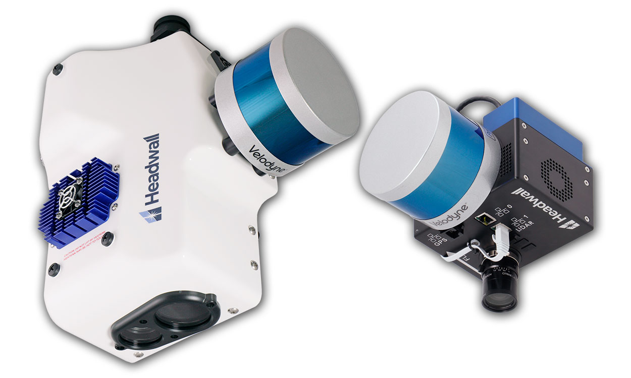
Airborne Hyperspectral Imaging (or Remote Sensing) is the collection and processing of information from across different bands of the electromagnetic spectrum via an aerial vehicle, such as a drone. Hyperspectral Imaging Sensors collect spectral information from a large area (such as a forest) as a set of images, allowing the identification of objects and materials through their individual characteristics (or “spectral fingerprint”).
We provide fully integrated, cutting-edge, out of the box airborne hyperspectral imaging solutions from Headwall Photonics, a market-leading US manufacturer of hyperspectral imaging sensors and spectral instrumentation. Our fully data-tested solutions combine a hyperspectral imaging sensor and choice of GPS/IMU mounted on a high-performance market-leading UAV, with LiDAR and a stabilising gimbal if needed. With powerful post-processing software capability, fully data-tested solutions and extensive training support available, you won’t find a more complete integrated airborne hyperspectral imaging solution!
Browse Airborne Hyperspectral Imaging Solutions below. Alternatively, call us on +44(0)1954 232 776 or email info@analytik.co.uk to discuss your requirements with a specialist.
Watch our video to find out more about airborne hyperspectral imaging.
Products & Services
We provide a range of hyperspectral imaging sensors from Headwall Photonics. Optimised for airborne use, our sensors are compact and lightweight – with total payloads falling well under the 25kg limit for Small Unmanned Aircraft under Civil Aviation Authority (CAA) regulations.
Offering professional performance from one of the world’s leading drone manufacturers, the DJI Matrice M350 is widely used across the globe, meaning easy access to local distributors and pilots – ideal for international projects.
With pre-installed arms and antennas for reduced set up times, a modular design making it easy to mount additional modules, and a lightweight design (up to 10kg), our airborne hyperspectral imaging package means regardless of which sensor, or combination of sensors, you choose, you’ll always be under the 20kg small UAV weight restriction.
Whether purchasing an airborne package with DJI Matrice M600 Pro, or just a sensor to integrate with an existing drone, we are able to provide full integration and training services to get you up in the air as soon as possible. Speak to a sales specialist for more details.
Containing several input ports for LiDAR, GPS/IMU, thermal, hyperspectral, and more, the data streams from each connected airborne instrument are combined with the use of a small and light ‘data-fusion’ hub called HyperCore™.
Available in standard and high-performance versions, the GPS/IMU provides geo-localisation information important for hyperspectral image orthorectification post-processing. High performance GPS/IMU uses post-processing and base station data for enhanced accuracy.
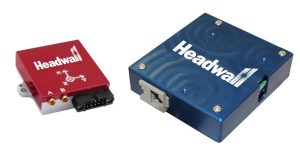
Find out how GPS/IMU accuracy affects LiDAR data capture and visualisation.
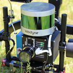
Aerial LiDAR is useful for forest mapping and crop-health analytics by providing information on plant height and density. Combining hyperspectral and LiDAR allows for more efficient flying since both data sets can be collected simultaneously. It also provides a more complete picture of how the landscape looks with respect to structure and vegetation types.
Integrating LiDAR with an airborne hyperspectral imaging package offers a number of benefits including:-
– Simultaneous hyperspectral and LiDAR cloud point collection from the same UAV platform.
– LiDAR tools software package for creating DEM files (for more accurate orthorectification) as well as fusing hyperspectral and LiDAR data.
From the basics of hyperspectral imaging to flight planning and post-processing, we can provide extensive on-site training to suit your requirements. This includes organising UAV flight and classroom training to obtain a CAA approved Unmanned Aircraft Qualification (UAQ) for commercial flying. Please ask for more details.
Hyperspectral basics
- Basics of hyperspectral imaging
- How the sensor works
- Airborne data collection considerations
Flight planning
- Flight planning and setup for data collection
- UgCS flight planning software
- Hyperspec III software and sensor setup
Post-Processing
- Viewing images and spectral data
- Single and batch radiometric correction
- Single and batch reflectance conversion
- Single and batch ortho-rectification
We provide a laboratory-based Hyperspectral Imaging Scanning System used to build a reference spectral library of data for the identification of characterised materials. It allows users to create a library of unique spectral fingerprints in a controlled environment for known material/infections/diseases etc.. Once created, these libraries can be used to help with classification of airborne hyperspectral data.
Example Solutions
VNIR + LiDAR on Stabilising Gimbal + High-Performance GPS/IMU
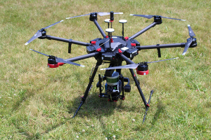
- Headwall’s Nano-Hyperspec® VNIR (400-1000nm) imaging sensor
- High-performance GPS/IMU and LiDAR
- Custom stabilising gimbal
- All data streams synthesized
VNIR-SWIR Co-Aligned + Internal Data Storage + GPS-IMU
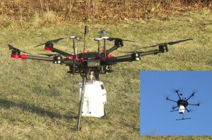
- Full hyperspectral data coverage from 400nm to 2500nm
- VNIR+SWIR co-aligned sensor package, the smallest and lightest of its type available
- Custom hard-mount
- Internal storage: (2) 480GB solid-state drives
- Internal GPS/IMU
SWIR 384 + High-Performance GPS-IMU + HyperCore™ Data Storage
- Hyperspec® SWIR 384 (384 spatial bands) covers the 900nm to 2500nm range
- High-performance GPS/IMU
- HyperCore™ data-storage (480GB solid-state)
- Custom hard-mount
- Headwall’s Telecentric lens
See the Technology in Action
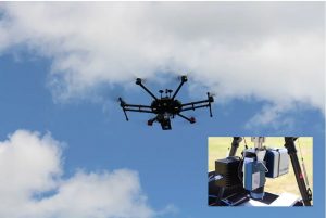
Headwall’s airborne hyperspectral imaging sensors are used aboard a variety of UAV platforms, including the DJI Matrice 600 Pro. Prior to being shipped, your airborne package will be professionally integrated and tested by the manufacturer, this includes being put through a range of data-collection and data processing exercises to assure perfect performance.
Quick Start Guide
Headwall has created a series of quick start videos so you know exactly what to expect from your airborne hyperspectral imaging system and how to prepare for your first flight! For more videos please visit the Headwall Photonics YouTube channel and subscribe to stay up to date with new videos.
Our airborne hyperspectral imaging customers
The first of its kind in Europe, the co-aligned VNIR SWIR airborne hyperspectral imaging system offers a significant leap forward in our hyperspectral data collection for earth observation research. Analytik were on-hand and responsive to our queries throughout the purchasing and after sales process, and continue to provide excellent advice and support. I would absolutely recommend Analytik’s services to my colleagues.
Jack Gillespie, Operations Technician at NERC Field Spectroscopy Facility
Articles & Papers
![]() Characterisation of rice paddies by a UAV-mounted miniature HSI system
Characterisation of rice paddies by a UAV-mounted miniature HSI system
![]() Utility of hyperspectral imagers in the mining industry
Utility of hyperspectral imagers in the mining industry
![]() Apple bruise detection using SWIR hyperspectral imaging
Apple bruise detection using SWIR hyperspectral imaging
![]() Identifying rice leaf blast & nitrogen deficiency in cold region using HSI
Identifying rice leaf blast & nitrogen deficiency in cold region using HSI
Applications
- Precision agriculture
- Forestry management
- Land contamination & chemical detection
- Environmental monitoring
- Mining/mineral exploration
CAN’T FIND WHAT YOU’RE LOOKING FOR?
Fill out a Contact Form, call +44(0)1954 232 776 or email info@analytik.co.uk to discuss your requirements with a specialist.


