Fusing LiDAR with Hyperspectral Imaging
What is LiDAR?
LiDAR (light detection and ranging) works by firing hundreds of thousands of laser pulses per second at a subject, then timing how long it takes for those lasers to be reflected and return to the sensor. This means that the sensor can calculate the distance between itself and the subject.

LiDAR sensors can be installed on aerial vehicles such as aeroplanes and drones. When used in airborne applications, sensors can gather huge amounts of data to create a highly accurate 3D image of the target area. LiDAR has been used to create 3D models of subjects such as towns and cities, mountain ranges, forests, and crop fields. By analysing the 3D model created by the LiDAR sensor, users can efficiently gather and analyse important characteristics of their subject.
To ensure the 3D model is accurate in terms of size and scale, the LiDAR sensor works in unison with a global positioning system and inertial measurement unit (GPS/ IMU). These track the movement and positioning of both the sensor and the aerial vehicle it is installed on to prevent variables such as pitch, roll, and heading, affecting the results.
LiDAR can be paired with Hyperspectral Imaging to produce a 3D model which highlights the spectral properties of the subject area. Hyperspectral imaging can highlight features that are both visible and invisible to the human eye by gathering information from across the electromagnetic spectrum. An example of this would be the detection of diseases and water stress of each individual tree that makes up a forest.
The spectral information gathered from the hyperspectral sensor can be applied to the LiDAR 3D model of the same subject area. By doing this, a 3D model of spectral data can be built, this would allow the user to see where on each tree the disease or water stress is occurring, which would allow them to efficiently strategise their solution. This would allow the prevention of further infection and deterioration of the tree’s health.
Headwall Photonics Hyperspectral LiDAR data fusion solutions
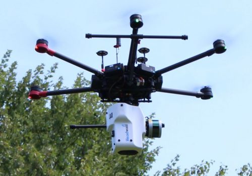
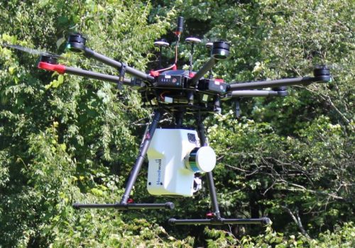
Headwall Photonics has introduced advanced sensor payloads consisting of hyperspectral sensors and LiDAR for deployment on Unmanned Aerial Vehicle (UAV) platforms. With the unique ability to simultaneously collect hyperspectral and 3D LiDAR data by combinining the Nano-HyperSpec (400-1000nm) and the Co-Aligned dual sensor (400-2500nm) Headwall continues to provide new industry-leading capabilities for addressing critical remote sensing applications ranging from civil and military infrastructure inspection to crop science applications requiring discrete solutions for crop monitoring. The Headwall payload consists of a Hyperspec® spectral imager, a LIDAR unit, a UAV, a high-performance GPS/IMU, and the associated software for data acquisition and workflow processing for exploitation. The combination of hyperspectral and LiDAR is especially powerful because the entire data set can be acquired on inexpensive UAV platforms with both sensor instruments operating simultaneously. Headwall’s software will allow for the control of both instruments, utilise the Digital Elevation Map for image creation, and allow for the merging of spectral datasets with the 3D point cloud. Headwall airborne/UAV packages can be combined and upgraded to have a 16-channel LiDAR unit, and includes the LiDAR Tools software package for creating LAS and DEM files (for more accurate orthorectification) as well as fusing hyperspectral and LiDAR data.
Find out more about Headwall’s Hypserspectral Imaging and LiDAR data fusion solutions , please contact us on +44 (0)1954 232 776 or email info@analytik.co.uk


